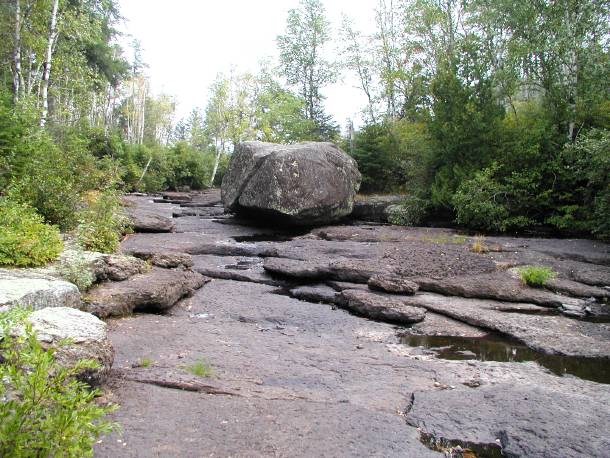
8/22/05 – After a summer of very light rainfall, water levels in Boundary Waters are dipping to lower-than-normal levels. Although most routes remain open, traveling with three or four people in one canoe is becoming increasingly tough, according to customer reports.
Here is the latest information regarding water levels on the popular routes in the Sawbill area:
Cherokee Loop – Cherokee Creek and Ada Creek remain open and fairly easily navigable. Jack, Weird and parts of Kelly Lakes are open but thick weeds and lily pads will slightly slow travel.
Lady Chain Loop – The river between Kawishiwi and Square Lake is low but passable–allow one extra hour for travel. Parts of the Phoebe River require a few pullovers.
Louse River Loop – Most of the already difficult Louse River is immune to low water levels. A few spots between Malberg and Boze Lakes require pullovers, but nothing longer than a few rods. The Bug to Louse Lake River is still closed due to a blown beaver dam. Stick to the northern Dent to Mesaba route when finishing the Louse River Loop.
Frost River Loop – The Frost River, described a few days ago by a customer as “misery,” should be considered closed to all but backcountry thrill seekers.
The Little Saganaga East and West Routes are mostly unaffected by the low water levels, except for the few parts overlapping with the routes described above.

The river between Koma and Malberg Lakes, normally a raging torrent, has slowed to a trickle.
