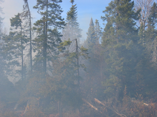
10/10/06 – Two large fires burned north of Brule Lake last month. The Forest Service declared them contained a couple of weeks ago and reopened the area for travel. Yesterday crew member Eric Frost and I took a day paddle up to see the effects of the Famine Lake Fire. The way we chose was to enter the BWCAW at Brule Lake and paddle up through the Cones (South, Middle, and North Cone Lakes) to Davis Lake. The most recent map we had, from September 17, showed that the far west end of Davis Lake had been touched by the fire. As we paddled and portaged north with Frosty’s dog, River, riding patiently in the middle of the empty canoe, we began to see some smoke coming from the direction we were heading. Smoke can be hard to place, however, and it seemed fairly distant, so we continued on our planned route.
When we arrived on Davis Lake, we turned west to see quite a bit of smoke down near the north shoreline, far from any portages. It turned out that the high winds that had blown all day on Sunday had kicked up the fire in a few areas; now, though, the wind was almost completely calm–so we headed over to check it out. The result was a fantastic photoshoot which shows how quickly a few small pockets of fire can consume dry forest.
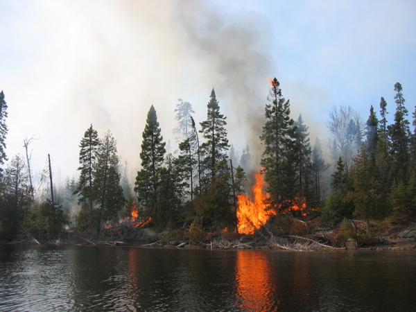
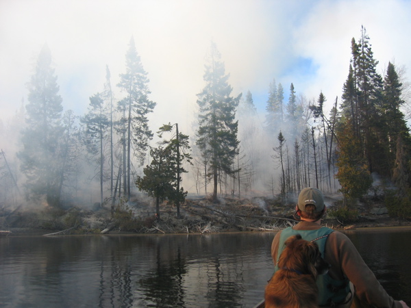
These shots were taken in the same spot on Davis Lake over the course of about an hour.
Later, we took some photos at a western campsite on Davis that had burned completely and is now closed to use so that we will be able to return over the next few years to an easily recognizable site to compare the systemic changes in the forest. Should be some good blueberries there in a couple of years! –Molly