2/29/12 – The Forest Service has released maps of entry points and campsites that are closed due to last fall’s Pagami Creek fire. Very few campsites that are normally used by Sawbill paddlers are closed. Below is the map that shows the few sites that are closed on the lakes just north of Kawishiwi Lake.
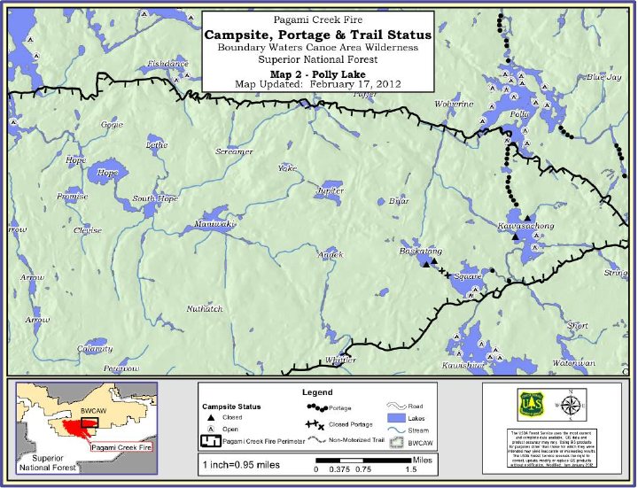
The map is a little crude. Polly has no burned areas that are easily visible from the lake. Square Lake is less than half burned. Baskatong, Kawasachong and Townline lakes are completely burned.
The snow depth has been pretty good as compared to the rest of Minnesota here at Sawbill. After the last couple of days it’s starting to look downright normal around here. – Bill

Anyone up for a picnic? You may not recognize the old BWCA Wilderness picnic table that sits in front of the Sawbill Store.