5/31/12 – Forest Service Naturalist, Steve Robertson, sent us a link to a fascinating cache of historic photos published in a searchable database by the Forest History Society. I’ve found a number of pictures of the Sawbill Campground in the 1930s and several early photos from what later became the BWCA Wilderness. – Bill
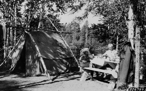
Tourists at Sawbill Lake Campground. (This campsite is south of the current picnic area on the path between the canoe landing and the handicapped fishing pier. – Bill) U.S. Forest Service, Eastern Region photograph courtesy of the Forest History Society, Durham, N.C.
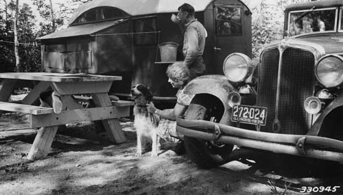
Camping by trailer at Sawbill Campground. Mr. and Mrs. C. A. Kremer, 8458 S. May St., Chicago. Negative Destroyed. Photo is in National Recreation Study and Report, 1937, page 57. (I think this site is in the current picnic area. – Bill) U.S. Forest Service, Eastern Region photograph courtesy of the Forest History Society, Durham, N.C.
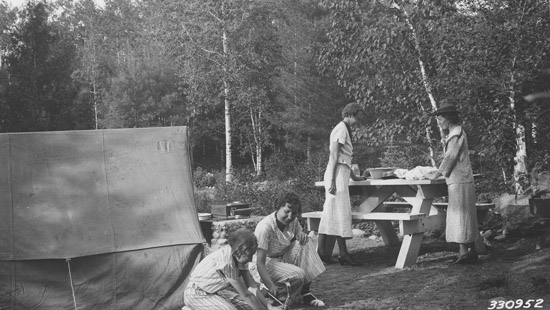
Campground scene at the Sawbill Campground. Mrs. Henry G. White, and Mrs. Wm. Murray of Osakis. Photo is in National Recreation Study and Report, 1937, page 42. (This site was located just west of the current public parking lot. It was in occasional use until the 1980s. – Bill) U.S. Forest Service, Eastern Region photograph courtesy of the Forest History Society, Durham, N.C.
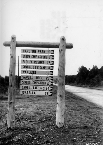
Road directional signs — instead of being scattered haphazardly around the junction, all are in one place. Junction of U.S. 61 and Sawbill #662. (I’ve never heard of Plouff Resort. Bill Plouff was a pioneer trapper and prospector. “Sawbill G. S.” refers to the Sawbill Guard Station, the cabin that still exists at the north end of the campground. – Bill) U.S. Forest Service, Eastern Region photograph courtesy of the Forest History Society, Durham, N.C.