
9/30/11 – All campfire restrictions have been lifted, both within and outside the BWCA Wilderness. As always, fires are only allowed in the fire grates provided at each campsite in the BWCA Wilderness and all fires should be put out cold before being left unattended.
The Pagami Creek fire is officially 75% contained, but it is now highly unlikely that it will kick up into a major fire again. We expect that more routes to the west of Sawbill will be reopened soon. – Bill
Author: Sawbill
Here’s the latest edition of the West End News from WTIP, North Shore Community Radio.
9/29/11 – Here’s the latest edition of the West End News from WTIP, North Shore Community Radio. – Bill
Leaf Peeping ’11
9/28/11- Fall in the Northwoods is not only a great place for grouse hunters, but also for those wanting to see some beautiful fall colors. The leaves are supposed to be at their peak this weekend, so I went for a drive today to scope out the view. What I saw was an interesting combination of trees- some that seem to be in their fiery red peaks, some that have lost their leaves already, and some that are still green! We think this variety is due to the extreme weather we’ve experienced this fall. With summer temperatures one day and snow the next, these trees don’t know what season it is. Whatever the case, the combination of greens, golds, and reds makes for a lovely walk in the woods. -Liz

Fiery red maple leaves

A blend of colors on the Honeymoon Trail

Fall foliage on the Sawbill Trail
Grouse season is here!
9/27/11- Grouse season is here! It has been an interesting season opener as many of the roads are closed in St. Louis, Lake and Cook Counties. There is an abundance of Conservation Officers around making sure that hunters and campers don’t wander into any dangerous areas affected by the fire. With road closures being revised constantly, new areas for hunting are opening as the roads re-open. Those who are fortunate enough to be in the area when the roads open are guests to prime grouse hunting. We at Sawbill are among those fortunate people. So fortunate, in fact, that we have planned a grouse feast for crew member Tyler Campbell’s 23rd birthday. -Luke

Homer inspecting our harvest for the day.
CO+ for 46
9/26/11- Soon after our entry point re-opened we received our first big outfitting assignment: supplying 46 fire fighters with 5000 calories worth of food per day for 7 days. Fire crews from all over the country have come to help, and are wiping out the freeze dried food selections from almost all the outfitters in the area. We ended up sending a total of 34 Duluth packs full of food, including but not limited to 20 lb. bags of meat per group, 6 pounds of cheese per group, and crazy amounts of coffee and cocoa. With Cindy’s direction, the entire crew helped by cutting cheese, packaging bulk foods, preparing cookkits, or whatever else needed to be done.
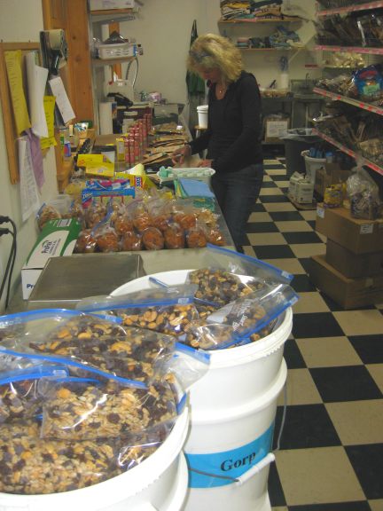
Cindy Lou utilizing her phenomenal packing skills
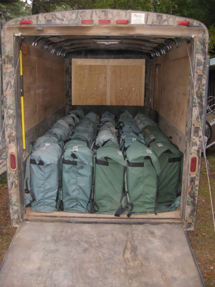
A perfect fit! Delivered in style…
Although the fire is now 53% contained, there are still 968 incident personnel working for the next few weeks to make sure the fire doesn’t continue to grow. If only we had any food left, we would love to help the remaining crews who still need outfitting. In total, we sent 10 aluminum canoes, 34 royalex canoes, 95 paddles, 88 life vests, and 34 Duluth packs stuffed with food to Kawishiwi Lake. Quite a change of pace after 8 days of being closed! -Liz
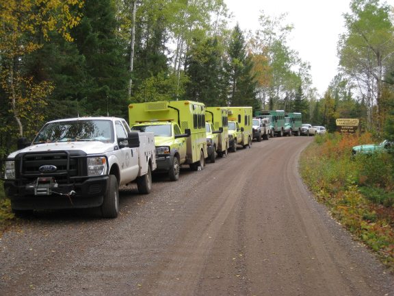
Fire trucks line the Kawishiwi Lake Road
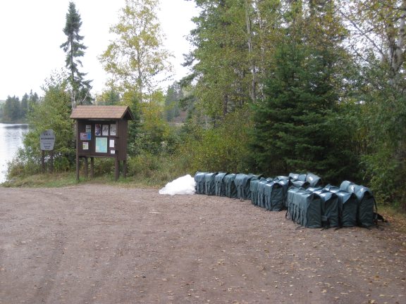
Luckily, these fire crews had a Beaver (float plane) to portage these food packs!
The Forest Service has decreased the size of the area that is closed due to the Pagami Creek fire.
9/23/11 – The Forest Service has decreased the size of the area that is closed due to the Pagami Creek fire. They have reopened a number of the roads south of the fire, but not all of them. Close to Sawbill, they have reopened the Parent Lake Road (CCHS #3) which is the road leading west toward Kawishiwi Lake. They also opened the Fourmile Grade Road (FR 170), which is the road that heads west of the Sawbill Trail toward Fourmile Lake and to the Trestle Inn, our favorite little backwoods bistro.
The Kawishiwi Lake and Hog Creek entry points are still closed, as is the Kawishiwi Lake Road (FR 354). – Bill
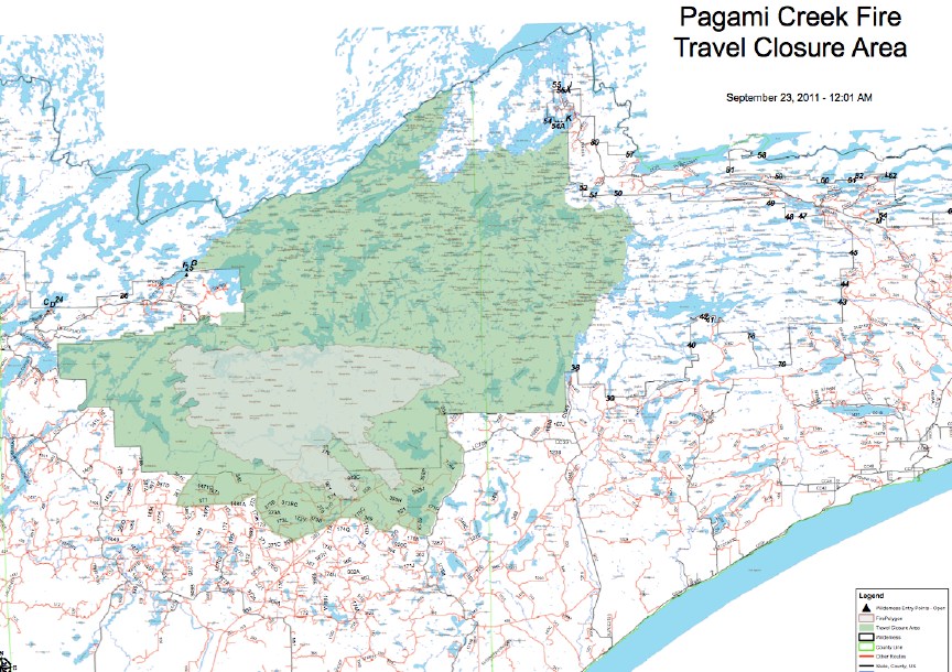
The new map of the closed area. The light green blob is the actual fire, the darker green is the closed area. Sawbill is on the right side of the closed area. I’ll post a link to the high resolution map as soon as it appears on the Pagami Creek fire website.
We just received news from the Forest Service that the fire ban has been reduced:
9/22/11 – We just received news from the Forest Service that the fire ban has been reduced:
Effective as of 12:01 Friday, September 23, 2011:
The following are allowed:
Between the hours of 6:00 pm and midnight, building, maintaining, attending or using a campfire anywhere on national forest lands within the Superior National Forest, including the Boundary Waters Canoe Area Wilderness.
In a fee-for-use campgrounds, a campfire may be used at any time.
9/22/2011 – Another cold, wet day at Sawbill – and we’re happy to have it.
9/22/11 – Another cold, wet day at Sawbill – and we’re happy to have it. In spite of the weather, the Forest Service is still in full fire fighting mode on the Pagami Creek fire. They’ve moved a bunch of firefighters into the Kawishiwi Lake area and have contracted with us to provide them with food and canoes. This is very nice for us because it replaces much of the income we lost over the eight days that we were closed.
The Forest Service has posted a bunch of images from the fire on Picasa. Pictures 142 and 143 are good images of the eastern-most tip of the fire, just south of Polly Lake and only about 8 miles from Sawbill.
Here is the latest issue of the Cook County West End News from WTIP North Shore Community Radio. – Bill
We received another .6″ of rain yesterday and there is more rain forecast for today.
9/21/11 – We received another .6″ of rain yesterday and there is more rain forecast for today. All the rain has put the fire down to the point that it would take some extraordinary warm, dry and windy weather to get it going again. Meanwhile, the 740+ firefighters, along with numerous aircraft, are making good progress on actually containing the fire.
The first canoeists are heading out of Sawbill this morning, now that the Sawbill Lake entry point and all the entry points east of Sawbill have reopened. A total fire ban remains in place, but I wouldn’t be surprised to see it lifted soon, especially for the campgrounds outside the wilderness.
Here are four pictures that were taken on Polly Lake a week ago Monday. Photographer Hans Martin posted these on Facebook. This was the peak of the most extreme fire behavior in recorded history for the Midwest. The pictures show what caused the burning that is pictured from the air in the post below. All four pictures are taken on Polly Lake looking to the south. If the wind hadn’t switched, this fire column would have arrived at Sawbill a little over an hour after these pictures were taken. We are very, very lucky. – Bill

Photo by Hans Martin taken on 9/12/2011 at Polly Lake.

Photo by Hans Martin taken on 9/12/2011 at Polly Lake.

Photo by Hans Martin taken on 9/12/2011 at Polly Lake.

Photo by Hans Martin taken on 9/12/2011 at Polly Lake.
9/19/11, 5 PM – Here is the map showing what part of the forest has been reopened.
9/19/11, 5 PM – Here is the map showing what part of the forest has been reopened. If you aren’t familiar with the lakes, the route from Sawbill up to Cherokee and Long Island lakes is open and all the lakes east of that line is open. Everything west of the Sawbill, Cherokee, Long Island line is closed. No word on the fire ban yet. We’re hoping for more rain in the next few days. – Bill
