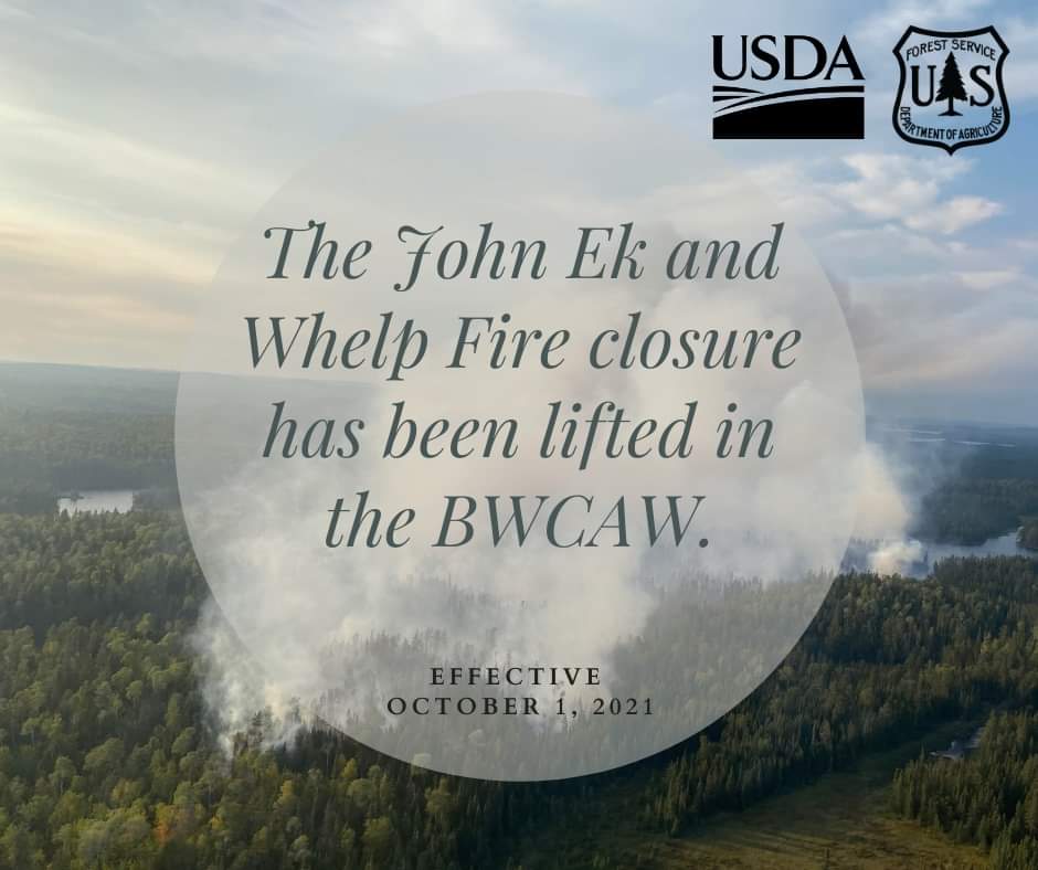
10/3/21 – We received notice late Friday afternoon that the Forest Service has lifted the BWCA closure area, effective immediately. The Whelp and John Ek fires have not shown any smoke for a couple of weeks, and we’ve received a more normal amount of rainfall over the last month. Shorter days and cooler temperatures are also contributing to the lessening fire activity and fire danger. This means that the Kelso Loop, Louse River, and Lady Chain routes are now open for travel.
An active fire season winds to a close.
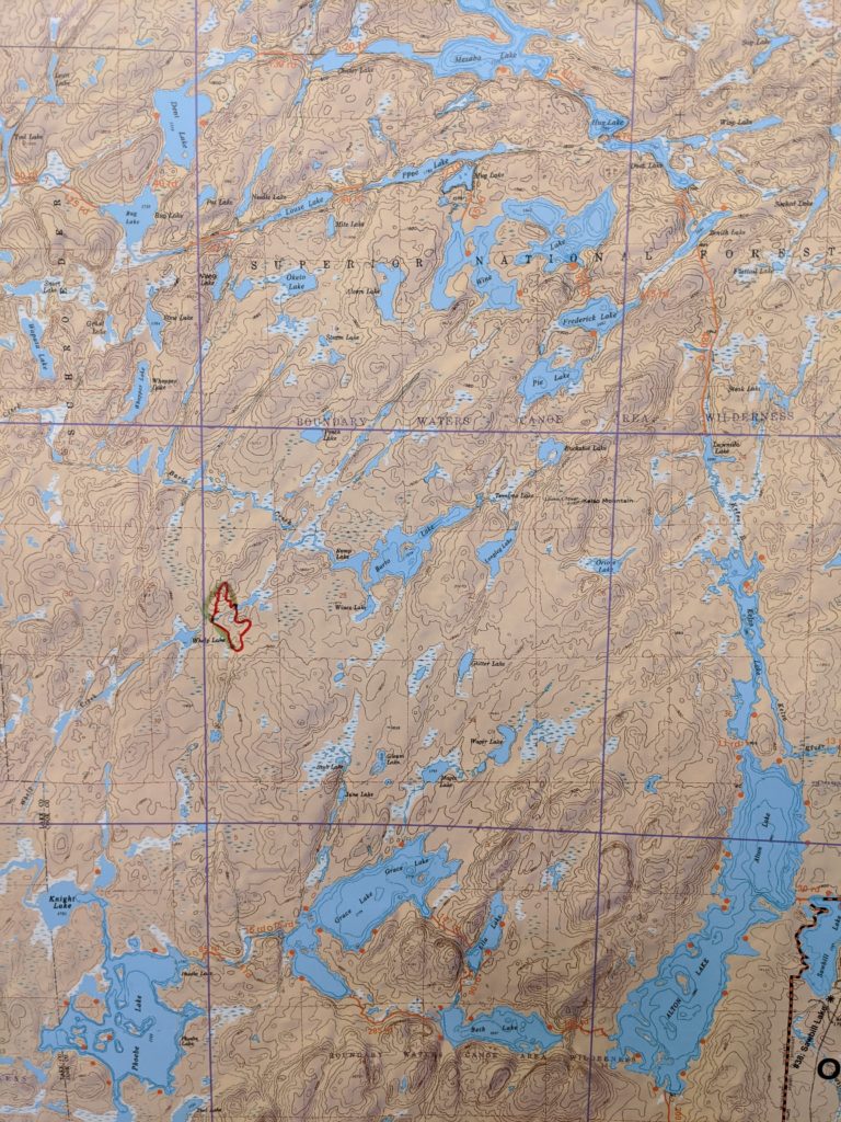
The Whelp fire never grew beyond 50 acres, and burned entirely in the remote wooded area north of Phoebe and Grace Lakes. The fire never reached any campsites or portages, so anyone travelling in the area this fall or in the coming seasons won’t see any evidence of this relatively small fire .
This is, roughly, the final footprint of the Whelp Fire.
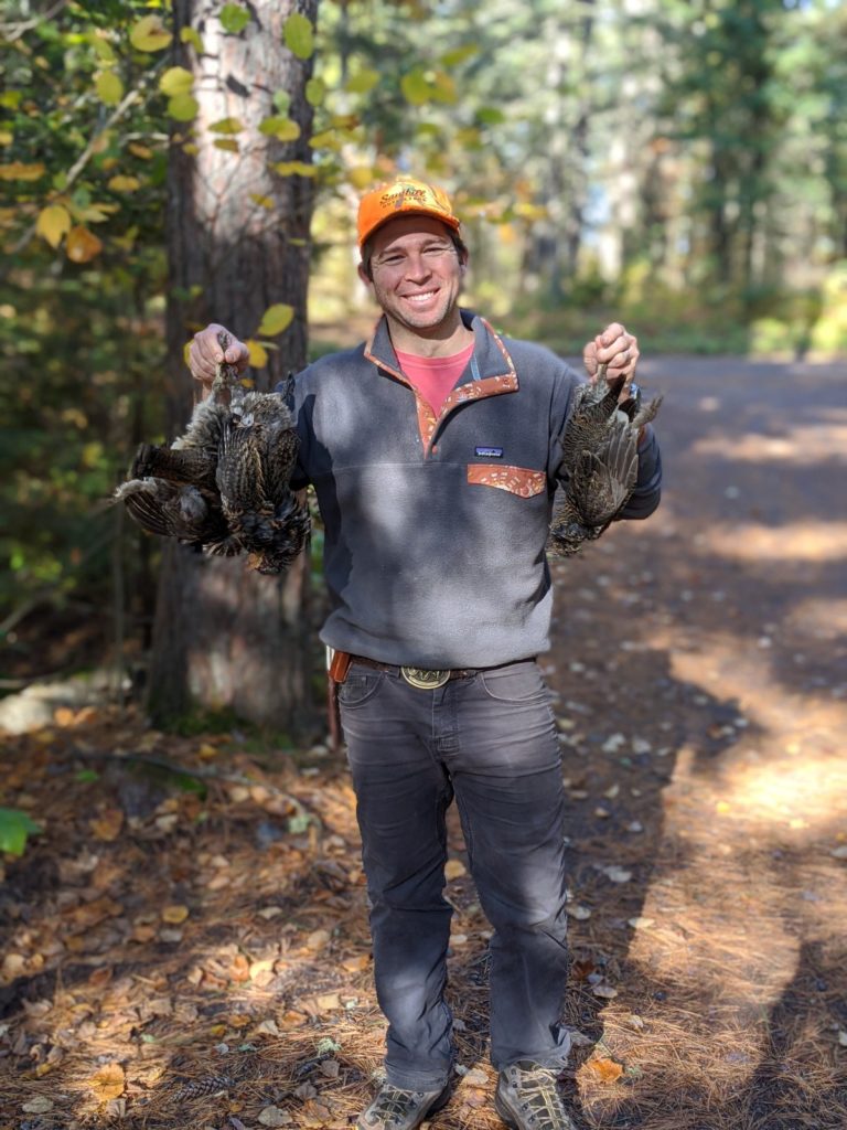
Grouse season is in full swing up here, with several Sawbill crew members partaking this year. It’s been a productive endeavor and we’re looking forward to some grouse dumplings soon!
Dan proudly displays his bounty.
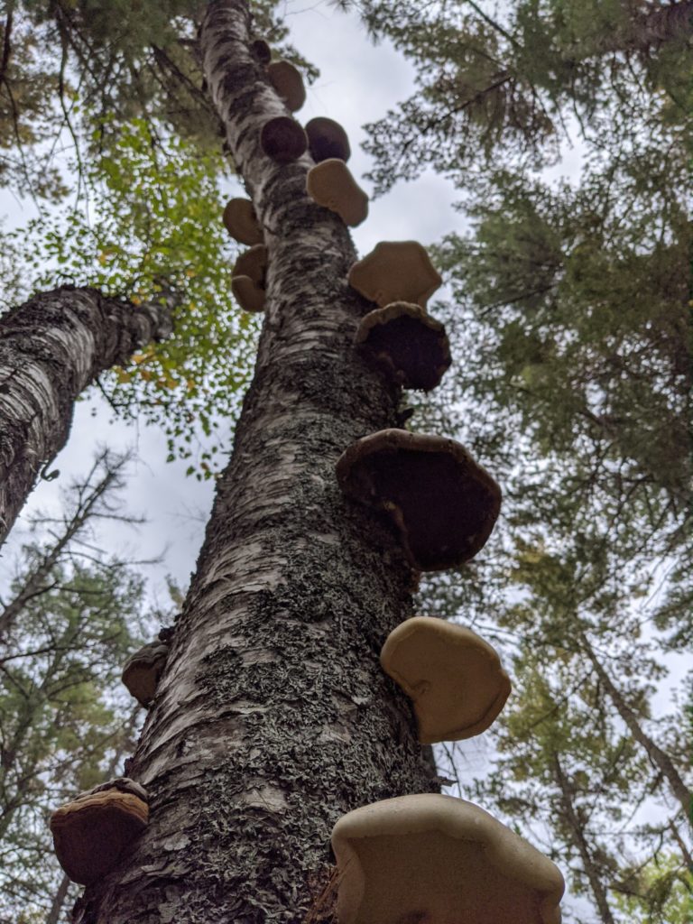
The more typical fall weather has also led to an explosion of fungi in the northwoods. It’s easy to get distracted by the brilliant fall colors, but the variety of mushrooms poking up from the ground and on the tree trunks and stumps really demand some attention.
Looking up at some stellar shelf fungus.
As of October 1st, the quota permit season in the BWCA has come to a close. From now until May, you only need a free self-issue permit to enter the BWCA, whether it’s a day trip or an overnight trip. These permits are found in boxes at entry point lakes, or at Ranger Stations. Here at Sawbill, we’ll be open regular hours until October 7th. After that, we’ll be here working on our fall wind down projects, likely with a note on the door that says find us if you need a canoe!
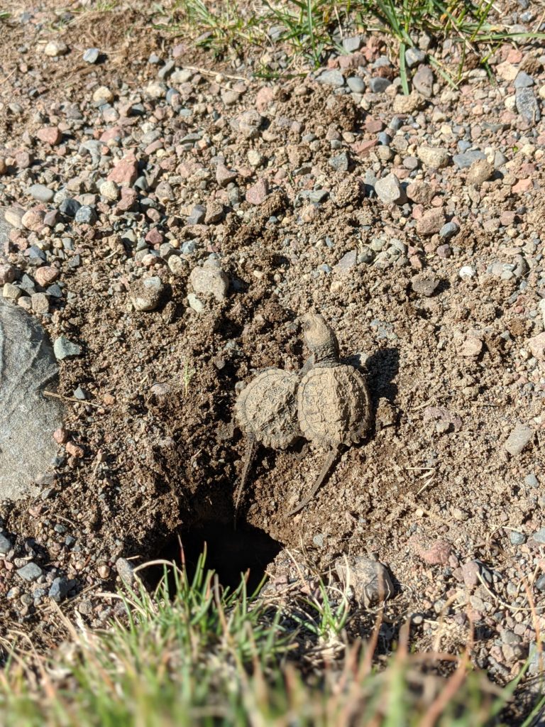
9/25/21 – September is winding its way to a close, and fall has certainly arrived here at Sawbill. The leaves are changing, the weather is cooler and wetter, and grouse hunters are prowling the woods. After the month long rollercoaster of fire risk and closures, the slowing pace and transition to fall projects is more welcome than ever. We had some excitement last week when the littlest outfitters, Kit and Sig, discovered a hole in the ground down by the canoe launch on Sawbill. Grandma Cindy quickly inspected to make sure it wasn’t a ground hornet nest (that’s another story) and much to her surprise she discovered a different sort of nest!
Baby snapping turtles, newly emerged from the nest.
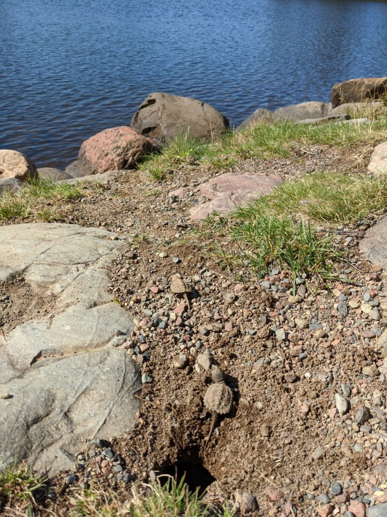
For years we’ve all watched as a big mama snapping turtle (or turtles, it’s hard to tell) laid her eggs down by the shore on Sawbill. Frequently, we later find those nests dug up, likely a meal for the neighborhood fox. None of us recall ever being present to see the tiny turtles hatch and find their way to the lake! Leave it to the curious toddlers to investigate everything. We were able to watch them throughout the day as they crawled their way out and hustled down to the water, where they got their bearings and swam off into the distance.
And they’re off! By the end of the day, there was a well worn trail from the nest to the water.
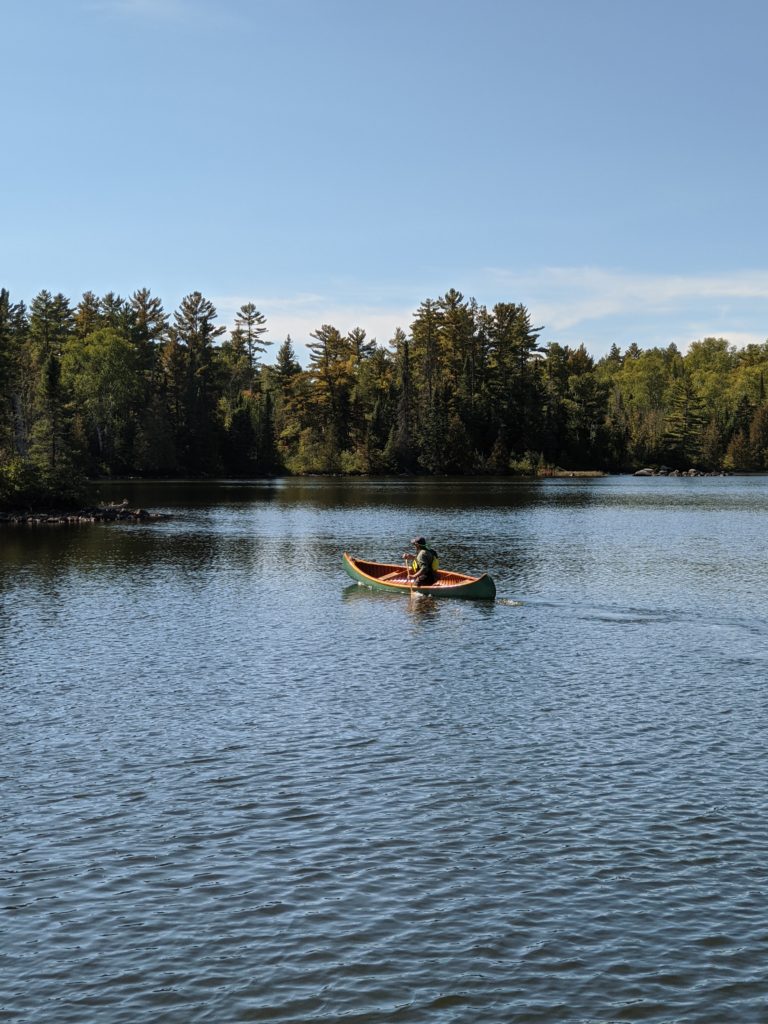
We were also pleased to visit with the group of wooden canoe enthusiasts during their annual visit to the Sawbill campground. Most visitors hold kevlar as the gold standard for BWCA canoes, but there’s something to be said for the craftsmanship showed in these beautiful wood boats.
A freestyle canoe demonstration on Sawbill.
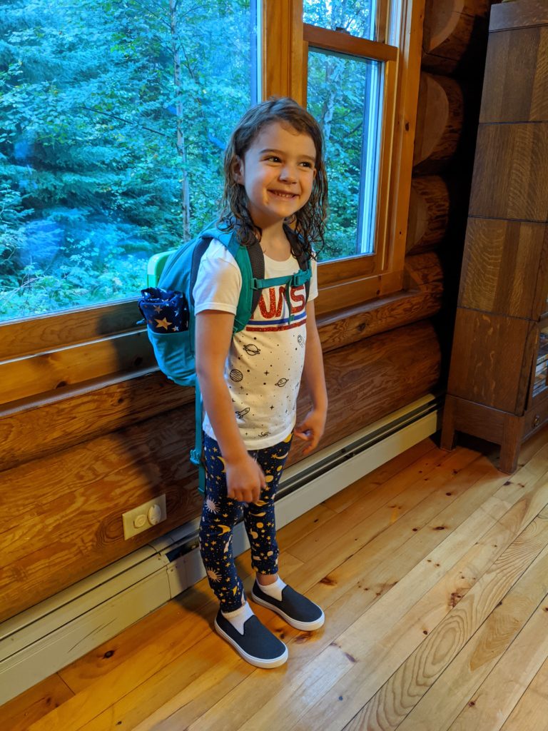
Kit Shirley has had a big September, she has started Kindergarten at Sawtooth Elementary in Grand Marais. So far she loves learning, especially Spanish class, and loves making new friends. She and her parents are cruising through audiobooks during the commute, and enjoying all the beautiful sunrises and fun animal sightings.
First day of school, she’s ready!
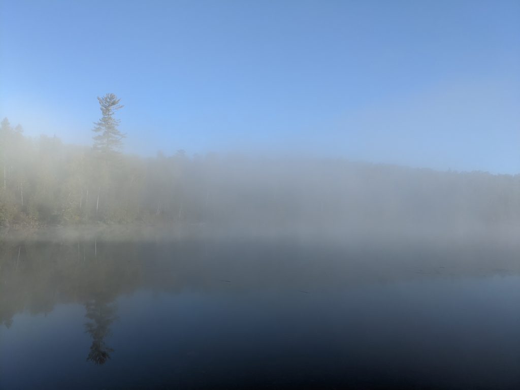
Beautiful misty mornings make for beautiful commutes.
9/18/21 – The Forest Service has lifted the fire ban in the Superior National Forest, including the BWCA wilderness. Thanks to some recent rains, cooler temps, and shorter days the fire danger has lessened. We are still experiencing a severe drought so while fire conditions have calmed down, things are still pretty dry with low water levels. We so appreciate everyone’s diligence in keeping our forests and homes safe during this extreme year!
The Sawbill crew wasted no time diving into fall activities.
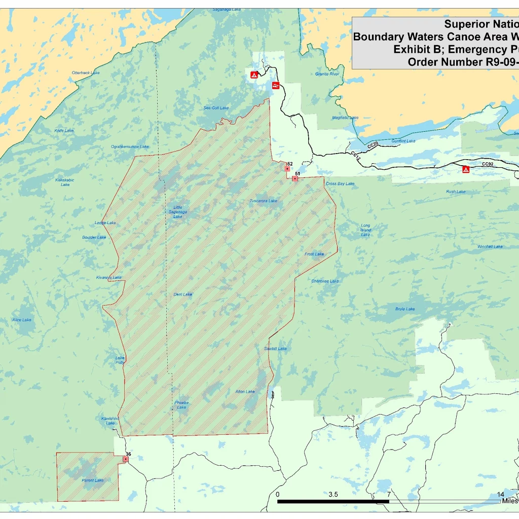
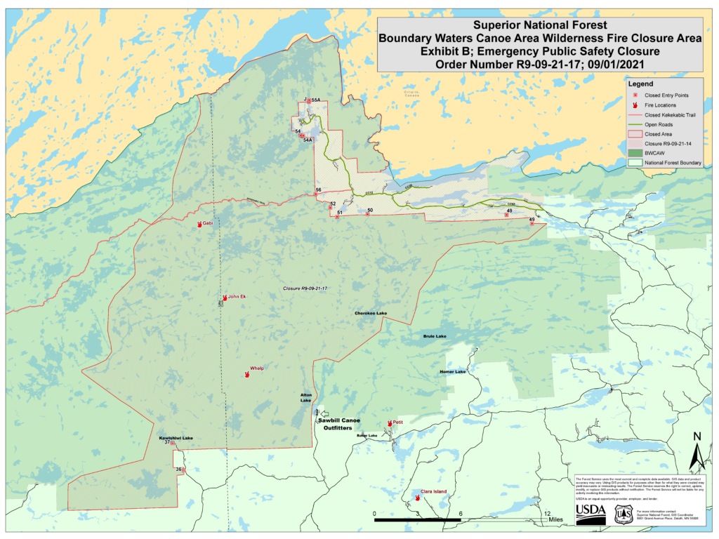
Even though the fire ban has been lifted, there is still a closure area within the BWCA. This means that the area shown on the map below is closed to all travel, including day-use. If you have any routing questions, don’t hesitate to ask!
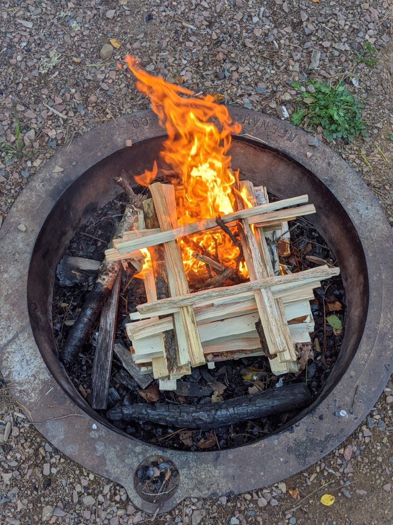
9/8/2021- Things are looking up for those of us that have been missing fires this summer! The SNF is going to be loosening restrictions on the forest, thanks to a change in the seasons. Starting September 9th, campers may have fires in designated fire grates in fee campgrounds! This is due to the dropping temperatures and the recent rain (Hooray!) This season has been touch and go because of the fires but if we work together and continue to follow restrictions we can safely enjoy campfires. On a personal note, it has been extremely encouraging how many campers who have celebrated the rain with me, so thank you to all of you who have kept a positive attitude when camping in the rain! That being said, Minnesota is still going to have drought conditions and with the right fuel and weather conditions, more fires could ignite. We ask you to take this in consideration and teach younger campers or first timers proper fire etiquette:
– Always keep an eye on your fire and if you leave the campsite, put the fire out.
– Keep fires to a controllable size, smaller fires are easier to put out.
-Have water near you before you start the fire, this makes it easier to put out a fire that gets out of hand.
-To make sure a sudden gust of wind doesn’t turn your campfire into a wildfire, keep anything flammable, including unused firewood away from the fire grate.
– Make sure you add enough water to the fire so that all coals are extinguished.
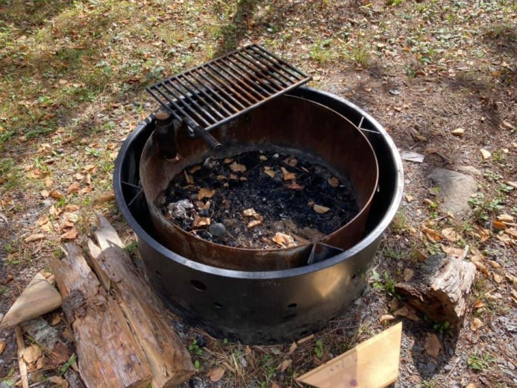
an example of a campsite fire grate!
What is allowed?
Campfires in designated fire rings that have been installed and are maintained by the Forest Service are allowed in the following fee campgrounds: Devils Track, East Bearskin, Flour Lake, Kimball Lake, Two Island Lake, Birch Lake, Fall Lake, Fenske Lake, S Kawishiwi River, Echo Lake, Lake Jeanette, Cadotte Lake, Pfeiffer Lake, Whiteface Reservoir, Crescent Lake, Divide Lake, Ninemile Lake, Sawbill Lake, and Temperance River campgrounds.
The use of pressurized devices with an on/off switch that are powered by gas or propane. This includes gas and propane powered devices such as stoves and lanterns.
What is restricted?
Campfires in rustic campgrounds, backcountry sites, dispersed sites and the BWCAW are not allowed at this time, even with a designated fire grate.
Other open flames such as tiki torches, charcoal grills and barbeques are not allowed.
Campfires and the use of fee campgrounds which are currently CLOSED to the public: Trails End, Iron Lake, McDougal Lake and Little Isabella campgrounds.
More information can be found on the Superior National Forest webpage along with this tab for the alerts and notices page.
9/4/21- Happy re-opening day everyone! We’re excited to get people back into the Boundary Waters once again!
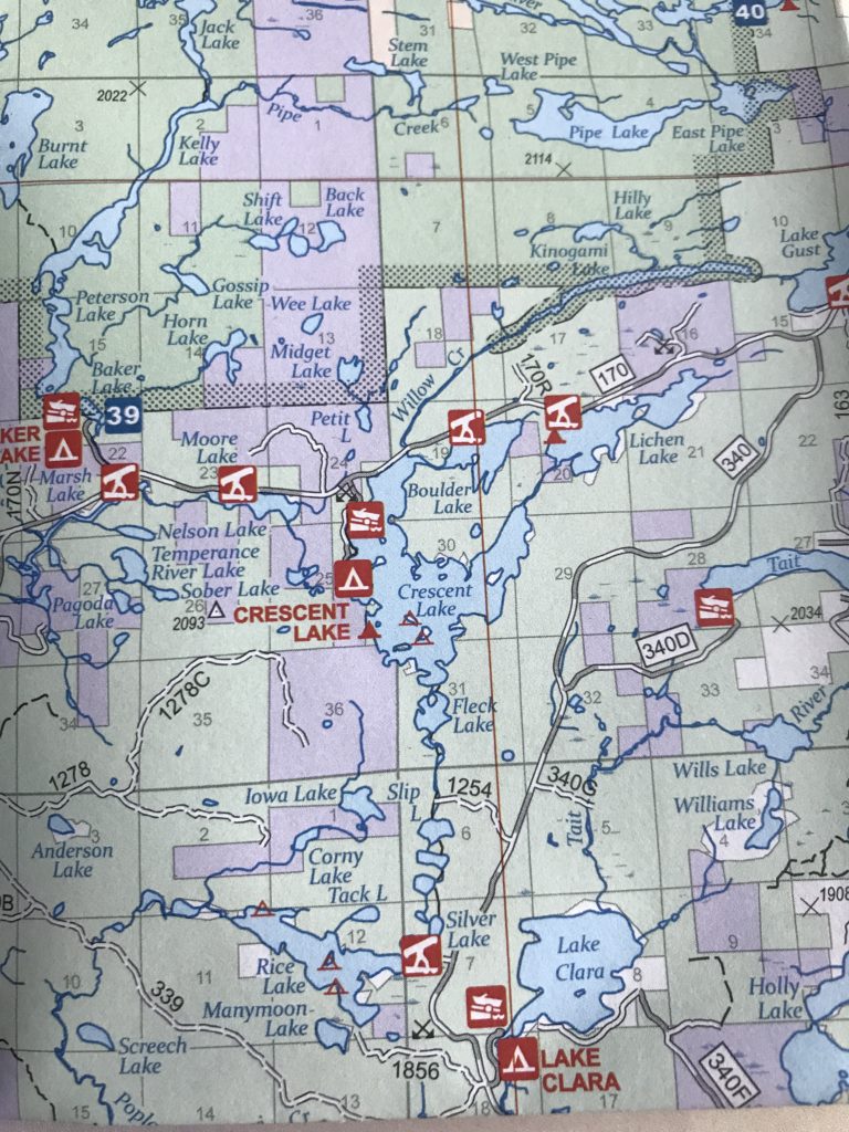
Another recent development is that the Forest Service has lifted their “Forest Closure Order,” which had effectively halted all dispersed camping outside developed campgrounds. So, if you are a person who’s original entry point is still closed and you want a plan “B”; areas such as the Timber-Frear canoe route and the backcountry sites on Crescent, Lichen, and Cascade Lakes are fair game again! A handy tool when finding these back road gems is the Superior National Forest map, which we sell on site.
As always, we’re happy to talk through possible alternatives by email, phone, or in person in front of the map. -Jessica
Small section of the Superior National Forest map showing possible alternative camping options outside of the Boundary Waters. Tent icons within a red square are multi-site campgrounds, while tent icons on their own are “individual non-wilderness campsites.”
9/1/21 – We’ve just received the exciting news that the full closure of the BWCA Wilderness area is being lifted, effective September 4th. There is a new closure area, however, in the vicinity of the Whelp and John Ek fires. I will include the full press release from the Forest Service below, but here’s what it means for the Sawbill area.
This is the new closure area, effective September 4th.
The new closure area, as seen above, will affect some of the Sawbill area. Two entry points near us, Kawishiwi Lake and Hog Creek, will remain closed until further notice. If you have a permit for one of those entry points, it will be automatically cancelled by the Forest Service. If you have a permit for Sawbill, Baker, Homer, or Brule (the other commonly used entry points in our area) starting on September 4th or thereafter – your permit is valid and you may go on your overnight BWCA trip. If you have not yet reserved a permit, available quota permits for those entry points will become available on September 2nd at Noon on recreation.gov.
Importantly, if you enter at any of the open entry points, you still may not travel into the closed area. This area includes the popular Cherokee Lake and other spots due north and west of Sawbill. Call us to talk through the available routing options.
The Sawbill Campground remains open and very quiet. Occupancy has been much lower than average for this time of year. Day trips will be open again starting on September 4th, so if you are worried about finding a backcountry BWCA campsite, staying in the Sawbill campground and day-tripping into the Wilderness is a great middle-ground option. You can reserve a site at Sawbill (at least four days in advance) on recreation.gov. Half of our 50-site campground is always first come, first serve.
The Whelp fire is holding steady at around 50 acres and hasn’t grown appreciably in the last week thanks to the hard work of fire fighters on the ground and more favorable weather conditions. We are not currently under any imminent threat of evacuation, and the air quality has been very clear for the last week. There is still a strict fire ban for the entire area, so please plan appropriately.
We are open! Sawbill is so fortunate to have such a dedicated and consistent crew that has stuck with us through this very uncertain time. We are privileged to have had the support of our community and extended Sawbill family, that has allowed us to weather this brief pause in outfitting with relative ease. Please let us know what questions you have. We are so excited to welcome you back to the Wilderness!
Below is the text of the official Forest Service press release regarding today’s news:
“The Superior National Forest is reopening some areas of the Forest, including the Boundary Waters Canoe Area Wilderness, given recent rains, cooling temperatures and progress made on active fire. However, certain closures will remain in place where active fires remain on the landscape.
The Forest is lifting the full closure of the BWCAW, the Crooked Lake closure near the fires in Canada. The Forest is slightly modifying closure maps for the Greenwood Fire, and the John Ek and Whelp Fires. The closure of Forest Service land at the Upper Gunflint Trail remains in place.
“We’re thrilled to reopen some of our public lands to visitors. The drought is not over but we’re starting to see more rain and lower temperatures. These conditions moderate fire activity and lessen the chance of new fires showing up,” said Connie Cummins, supervisor for the Superior National Forest.
“After talking with our fire experts about the latest data and weather conditions, we believe we have the capacity to manage the potential risk to the public of wildfire in some portions of the Forest,” Cummins added.
What this announcement means for visitors:
Full BWCAW Closure is being lifted: Portions of the BWCAW will reopen, effective September 4, including the Crooked Lake area near Canada.
If you had a previously reserved permit for after September 4, your permit is still valid.
Available quota permits will be live for reservation on Thursday, September 2 at 12:00 PM on Recreation.gov.
BWCAW Closure due to John Ek & Whelp fires: A new closure area has been drawn for the John Ek and Whelp Fires: Seagull Lake EP #54/#54A/L, Saganaga Lake EP #55/#55A/J, Missing Link Lake EP #51, Brant Lake EP #52, Cross Bay Lake EP #50, Kekakbic Trail EP #56, Skipper and Portage Lakes EP #49, Kawishiwi Lake EP #37, Hog Creek EP #36.
Upper Gunflint Trail closure: Forest lands and roads along the upper Gunflint Trail remain closed. However, the Gunflint Trail and private land and resorts are open. Trails End and Iron Lake campgrounds remain closed.
Greenwood Fire closure: A closure remains in place for the Greenwood Fire, however it has been slightly modified to open the Stony Spur and a portion of prospector Loop Trail, which allows ATV riders to safety ride from Babbitt to Ely, Minn. The following entry points are closed due to Greenwood Fire: Island River EP #34, Isabella Lake EP #35, Bog Lake EP #67, Little Isabella River #75, Snake River EP #84, and Pow Wow Trail EP #86.
Of the 65 fires reported on the Forest in 2021, nearly half, or 29, have been caused by humans. To minimize risk of human-caused fires, fire restrictions remain in place across the entire Forest. Open flames are not allowed, including campfires and charcoal grills. However, visitors may use propane or gas-powered devices with on/off switches.
“Although risk is being mitigated by the change in the seasons, it’s not completely eliminated. In the fall, we can get an alignment of low humidity, high winds, and high temperatures and a fire can get up and moving. This has happened in the past. The typical fire season for northern Minnesota extends through September,” said Cummins.
The Forest is evaluating other current closure orders with our state partners and will notify the public when we have additional updates. Please visit the forest website for more information or call your local district office.”
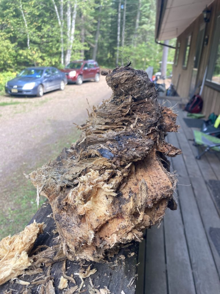
8/31/2021- In the midst of some chaotic crew bonding last night, we received a knock on the door which was nonother then our magnificent leaders Clare and Dan (along with our favorite fuzzy friend Huckleberry!) Clare told us we needed to step outside and see what she brought us, so we did. What we saw blew our minds! It was a little thing called foxfire.
A fresh picture of the wood in the daylight!
The glow captured from Sawyer’s Google Pixel 4 camera! (SO COOL!)
Foxfire can also be known as “Fairy Fire” which is the reaction of a fungi eating rotting wood. The fungi creates light due to the chemical reaction that occurs when the fungi cells consume the wood. The oxidative enzyme luciferase reacts with luciferin, creating the glow. This has been documented throughout time, the earliest was noted from Aristotle who claimed the fungi to be a “cold fire” emanating in the woods. I had never heard of Firefox before last night but it was really awesome! Go explore the woods at night and maybe you will also get the chance to see this natural glow!
“Bioluminescent life forms create their own light by mixing certain chemical compounds together to form a glow. As this luminescence neither requires nor produces heat (unlike much light humans use), it is often called cold light. Scientists estimate that creatures produce light either to scare off predators or to attract insects and promote the spread of spores. Either way, bioluminescence is equal parts breathtaking and eerie when one stumbles upon it in real life.” Information Pulled from: https://allthatsinteresting.com/foxfire-bioluminescence
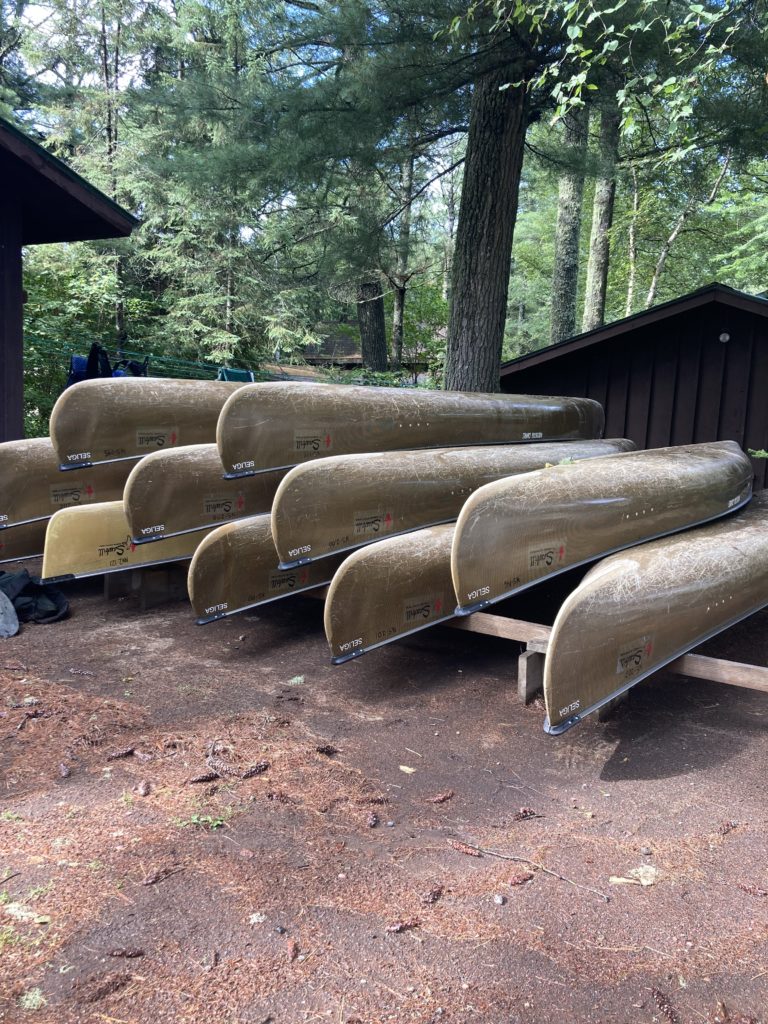
8/30/2021- Every fall we sell our used canoes. This is a great opportunity for our boats to find new, loving homes! So if you or someone you know are searching for a gently used canoe, send them our way! We will be selling canoes through our online store: https://sawbill.com/product-category/used-canoes/
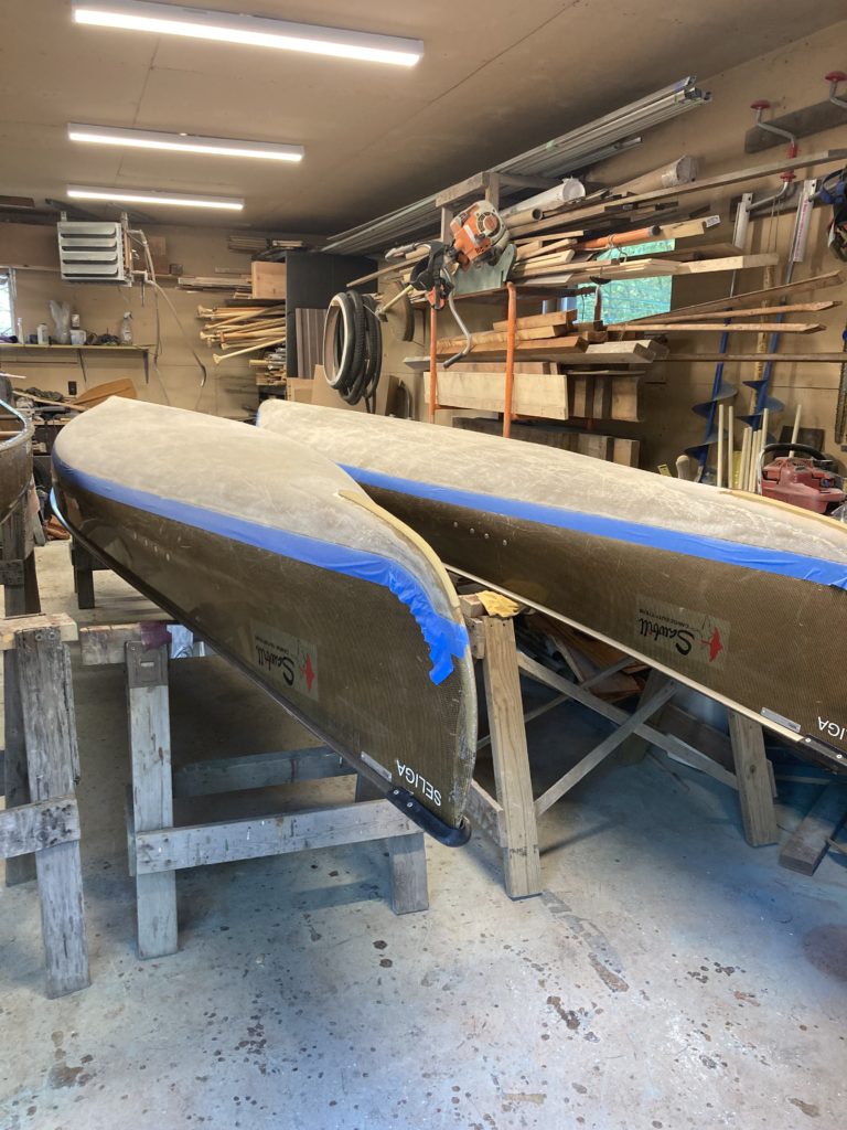
New Skid Plates!
A few Seligas waiting for their turn in the workshop
We just sold our first canoe and are excited to to answer questions and prepare the rest of the boats to be sent off. Further questions on the actual process can be found on the blog post below. This blog post talks about replacing the skid plates, the new resin coat, and other repairs we may make before listing the boats!
8/27/21 – While it hardly seems possible, the Forest Service has just announced further closures in the Superior National Forest. In addition to the existing closure of the BWCA Wilderness and the closure area surrounding the Greenwood fire, they have announced a closure of the undeveloped camp spots in the Superior National Forest.
The Press Release states:
“Effective August 27, camping on Superior National Forest lands outside of developed campgrounds will be closed. Day use is allowed on the forest and most developed campgrounds (fee and non-fee) remain open to public use. Please review the Forest Closure Order for a list of open campgrounds.
Forest officials made the decision to enact this closure in the interest of public safety as the forest continues to experience severe to extreme drought, high fire risk and multiple active fires.
Closing camping outside of developed campgrounds reduces the possibility of the following:
Search and rescue resources being diverted from firefighting operations.
The need for emergency evacuations should additional wildfires occur.
The chance of illegal campfires. Despite the current fire restrictions, there have been multiple reports of illegal campfires on the forest and several of those illegal campfires have caused small fires on the forest which divert resources away from priority fires.
This closure will be in place until it is safe to lift, forest resources are freed up from firefighting, and likely until the Arrowhead receives a season-ending rain or snow event.
The Superior National Forest is coordinating with the State of Minnesota, who will be implementing similar closures across the Arrowhead Region due to the challenging natural resource conditions.
In addition to this camping closure order, the Forest has several other closures in place for the Greenwood and John Ek fires. Developed campgrounds in those closure areas include McDougal Lake, Little Isabella, Iron Lake and Trails End campgrounds. The Boundary Waters Canoe Area Wilderness is also closed at this time and permits have been refunded through September 3.
Please visit the forest website for more information or call your local district office. “
Now for the million-dollar question: Where can you camp right now? Here’s the list, per the official order:
Devils Track Lake Campground
East Bear Skin Lake
Flour Lake
Kimball Lake
Two Island Lake
Birch Lake
Fall Lake
Fenske Lake
S Kawishiwi River
Echo Lake
Lake Jeanette
Cadotte Lake
Pfeiffer Lake
White Face Reservoir
Big Rice Lake
Crescent Lake
Ninemile Lake
Sawbill Lake
Temperance River
Baker Lake
Cascade River
Clara Lake
Four Mile Lake
Harriet Lake
Hog Back Lake
Kawishiwi Lake
Oxbow
Poplar River
Silver Island Lake
Toohey Lake
Trestle Pine
White Pine Lake
White Fish Lake
Wilson Lake
To be clear, when it says you can camp at Sawbill Lake, Baker Lake, and Kawishiwi Lake, what it means is that the campsites in the established campgrounds are open – NOT the backcountry lake sites that are within the BWCA Wilderness.
In happier news, they were able to put 14 firefighters in on the Whelp fire today. While we haven’t received any measurable rain, it has been overcast, humid, and drizzling on and off all day. This is good firefighting weather, and we are feeling hopeful and grateful for the crew working on the Whelp fire. We were happy to be able to pack food for that crew, and we made sure to include lots of high-calorie, high-carb eats!
We are using our down time to work on some of the used canoes that will be for sale this season. Expect the first batch to go live on the website in a couple of days, with more available as they are done being refurbished.
As always, thank you for following along with us, and please let us know what questions you have.
8/24/21 – Not surprisingly given the very active fire days recently, the US Forest Service has decided to extend the closure of the BWCA Wilderness. Overnight permits for the period of August 28th – September 3rd were cancelled today (and automatically refunded).
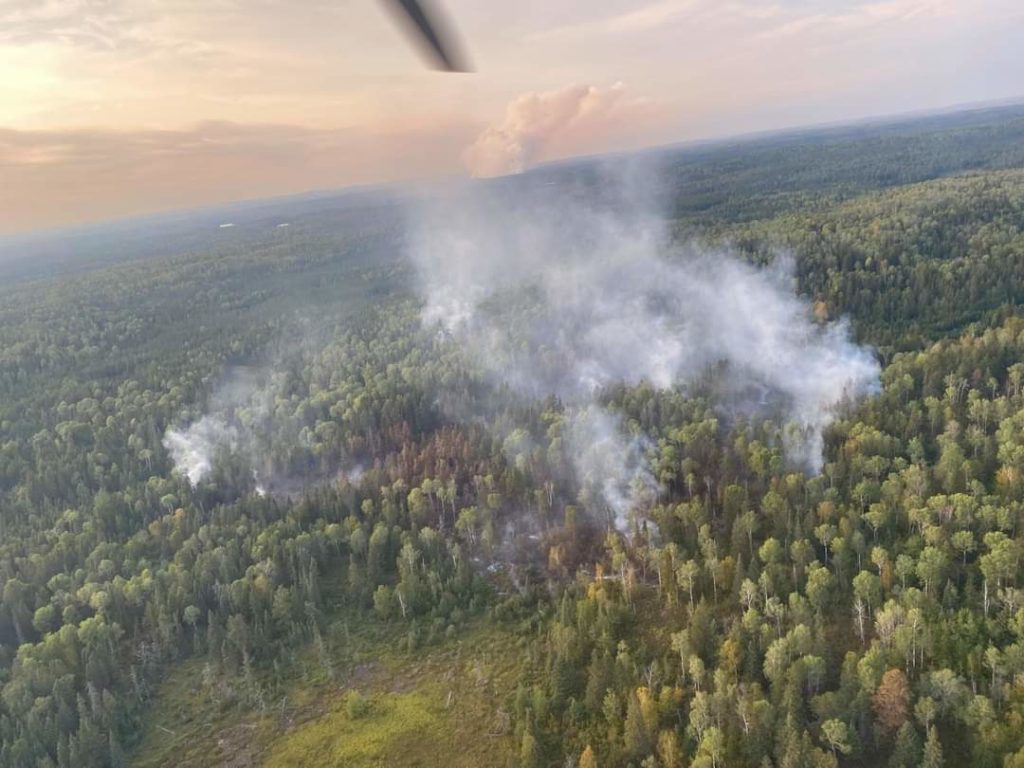
The Whelp Fire miraculously showed very little growth over the last few days. It remains at about 50-60 acres. The John Ek fire grew to about 1500 acres, mostly to the east and northeast. There were some new fire starts, the only one near us was about a mile north of Crescent Lake just across the border of the BWCA, it is being called the Petit Fire. It is currently under an acre in size and has a fire crew actively working to contain it. Thankfully, it is in a very accessible area and they anticipate having it contained very quickly.
Aerial view of the Whelp fire today, courtesy of the Superior National Forest.
We continue to be in a safe position, with no evacuation orders imminent. We had a brief 12 hour period, from late last night until this afternoon, of bad smoke from the Greenwood fire. The winds have shifted and thankfully we had clear skies this evening.